Endangered Landscapes
TEXT BY SARAH TASLIMI, OALA
It’s easy to think of landscapes as being static: a vista, a backdrop, a picturesque painting on a wall. The figures in the foreground may change but the scene behind them feels immutable. Iconic landscapes become great wonders that lie in wait for intrepid travelers to capture in the same photograph, over and over again. As landscape architects, we know that nothing is static, but it is still difficult to think of time at the geological scale. When I hear the word ‘endangered,’ my mind jumps to the Jefferson salamander, the grey fox, or the spotted turtle. Barring an imminent development application or a contested pipeline, landscapes aren’t often thought of by many as an endangered species.
More and more, our iconic landscapes face a range of stress factors that threaten to destroy both the destination snapshot and the important habitat it is part of. The old dangers of wind, water, and ice are ever-present, bringing with them weathering and erosion. Added to these are tillage and other agricultural practices, logging and housing development, urban growth and tourism. Climate change is bringing about landscapes that have not been seen in 40,000 years, as in the case of Baffin Island. The following is an exploration of six quintessential Canadian landscapes in distress, and some of the stewardship efforts and policies that attempt to reframe them as inextricably linked with human activity.
Elephant Rock: Erosion & Climate Change
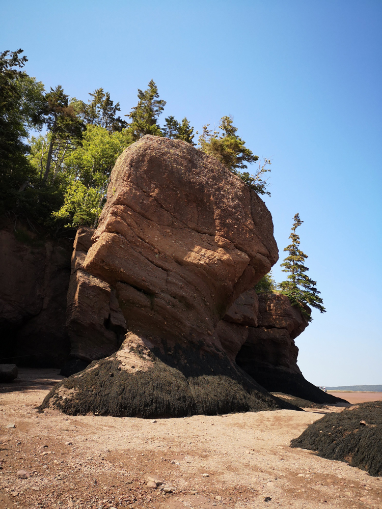
In March 2016, the iconic Elephant Rock formation at the Hopewell Rocks in New Brunswick collapsed. Some 200 tonnes of famously photographed rock crumbled into the Atlantic Ocean, closing off an entire passageway to the site’s interpreters and thousands of tourists. The very same forces that created the historic landmark and its surroundings—air, wind and water—also pose a constant threat. Staff use this event as a teaching moment to demonstrate that the layers of conglomerate, sandstone, and shale are constantly changing, disintegrating and reforming over time. While erosion itself is framed as cyclical, rising sea levels and increasing rainfall caused by climate change speed up the process, so that flowerpot formations disintegrate more quickly than they are formed. Although policies such as the Climate Change Act have been put forward by the government of New Brunswick, the threat to the east coast is not a problem that can be solved by a single province. Wide-reaching federal action is the most necessary and compelling solution.

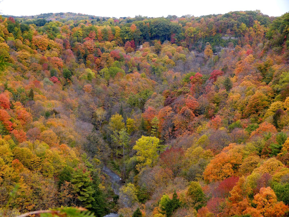
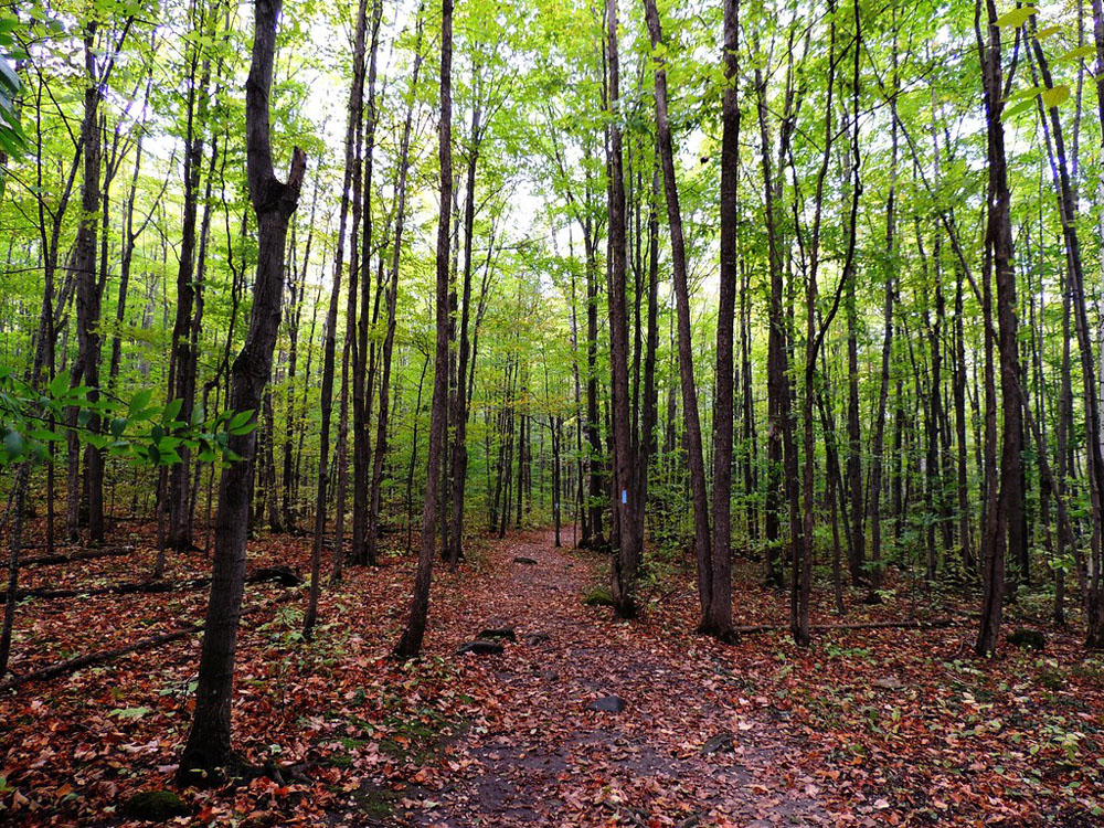
Carolinian Forest: Urbanization
The Carolinian Forest ecosystem is arguably the nearest to extinction of this collection of threatened landscapes. Once encompassing most of southern Ontario, this unique ecozone of approximately 20 deciduous tree species has been hacked away by urban development, agriculture, and invasive species that are introduced and spread by human movement. Small pockets of the forest remain, segmented by jersey barriers, fencing, highways, and housing, so that its inhabitants are isolated from one another. The old growth, biodiversity, and large breeding mammals of the pre-European Carolinian Forest have all disappeared. To reconnect the fragments, municipalities bargain with developers, trading permit approvals for the dedication of land towards ecological restoration. However, it takes a long time to grow an old growth forest, and our cities are growing much faster.
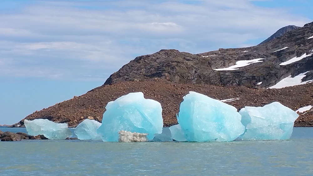
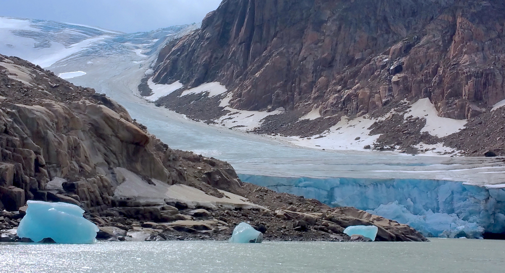
Baffin Island: Climate Change
In the far north, on Baffin Island, rapidly retreating glaciers have exposed landscapes that have been continuously covered in ice for the last 40,000 years. According to researchers studying ancient dead moss and lichens, the entire island is likely to be ice-free in the next few centuries. The disastrous impact this will have on the island’s wildlife—polar bears, snow geese, caribou and arctic wolves, to name a few—is distressing, but unfortunately not unimaginable. In the case of Baffin Island, it is not the actions or lifestyles of its 13,000 inhabitants that are causing such a dramatic change, but a worldwide warming trend towards the disappearance of permanent sea ice and the melting of the permafrost. Whether humans can rise to the challenge of climate change on a global scale remains to be seen.
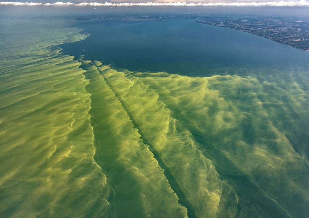
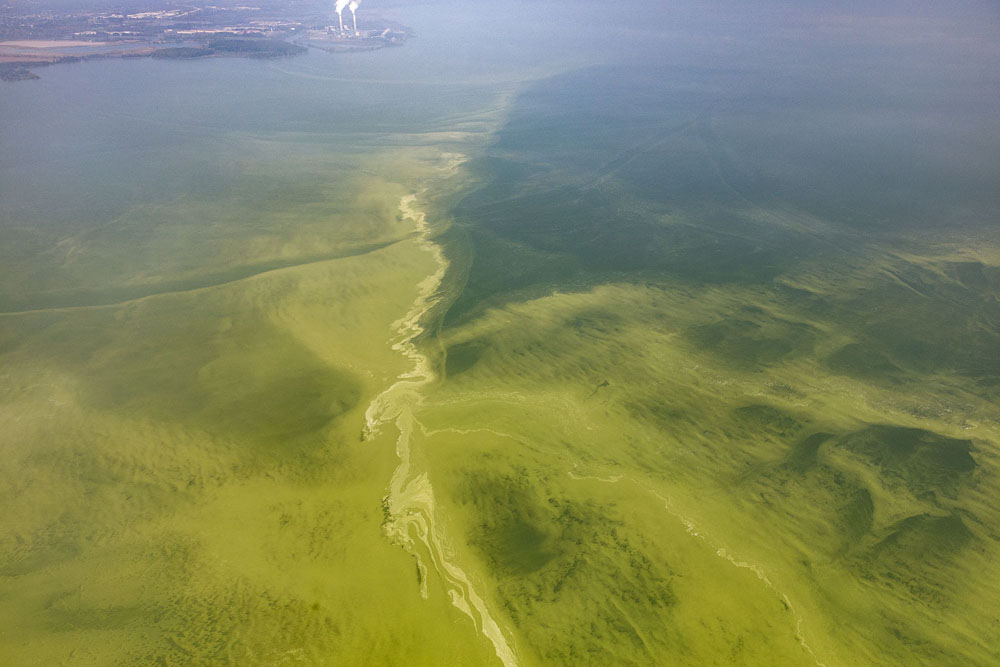
Lake Erie: Agriculture, Invasive Species & Climate Change
The bright green hues of Lake Erie’s algae blooms have been a focal point of concerns over pollution, water quality, and climate change for decades. In the 1960s, phosphorus and nitrogen loading from detergents, fertilizers, and waste-water treatment plants hit critical mass, and the lake was deemed “North America’s Dead Sea,” owing to its oxygen depletion and shores littered with dead fish. In an international effort, Canada and the United States responded by capping household phosphates and upgrading its sewage plants. Lake Erie’s algae subsided, and it was hailed as an environmental success story. Half a century later, the bloom is back. Half of the phosphorus dumped into Lake Erie flows from Ohio’s Maumee watershed. Fertilizer, in the form of liquefied animal waste and pellets, is sprayed onto untilled farms and then washed away by increased rain and snowmelt caused by climate change. Helping the toxic algae along is the invasive zebra mussel, which eats non-toxic green algae and eliminates the toxic algae’s competition, as well as the main food source for Lake Erie’s fish. With one province and four states claiming shoreline along Lake Erie, another international movement is needed to change agricultural practices, eliminate invasive species, and prevent Lake Erie from being declared dead for a second time.
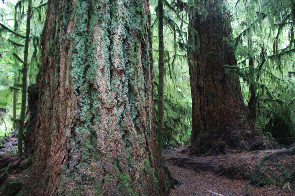
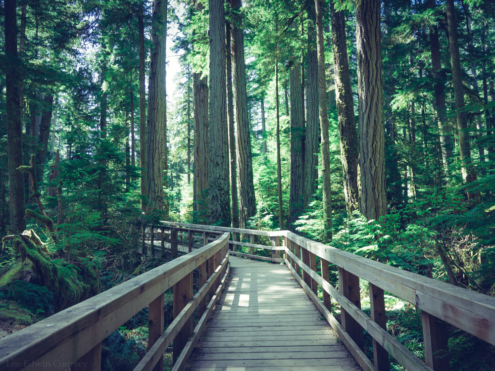
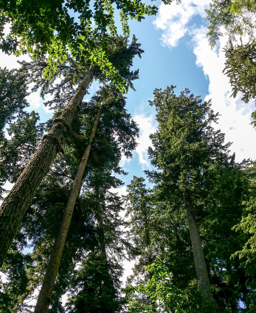
Cathedral Grove: Logging
Located within the small MacMillan Provincial Park, Cathedral Grove is a museum-like remnant of British Columbia’s ancient Douglas fir trees. The park draws approximately 500,000 visitors annually, who come to view the 800-year old giants in one of the only remaining areas where the old growth ecosystem is protected. With only about 1.2 per cent of the original coastal Douglas fir ecosystem remaining, Cathedral Grove is becoming increasingly isolated. Logging companies use the freedom afforded by the Private Managed Forest Land Act to cut down old growth trees, in exchange for the promise to reforest the area, otherwise paying an “exit fee” to shirk the responsibility. Environmental groups and Indigenous peoples have protested the destruction of B.C.’s forests for decades, but as the number of ancient trees dwindles and logging companies enter increasingly visible areas such as hiking trails and hillside vistas, the controversy has reached a heightened state. In May 2019, the B.C. government announced a review of the Private Managed Forest Land Act, and recommendations were made this fall. Until then, there is nothing to stop a landowner from exiting the program for a small penalty, clearcutting the land, and selling it to a private developer.
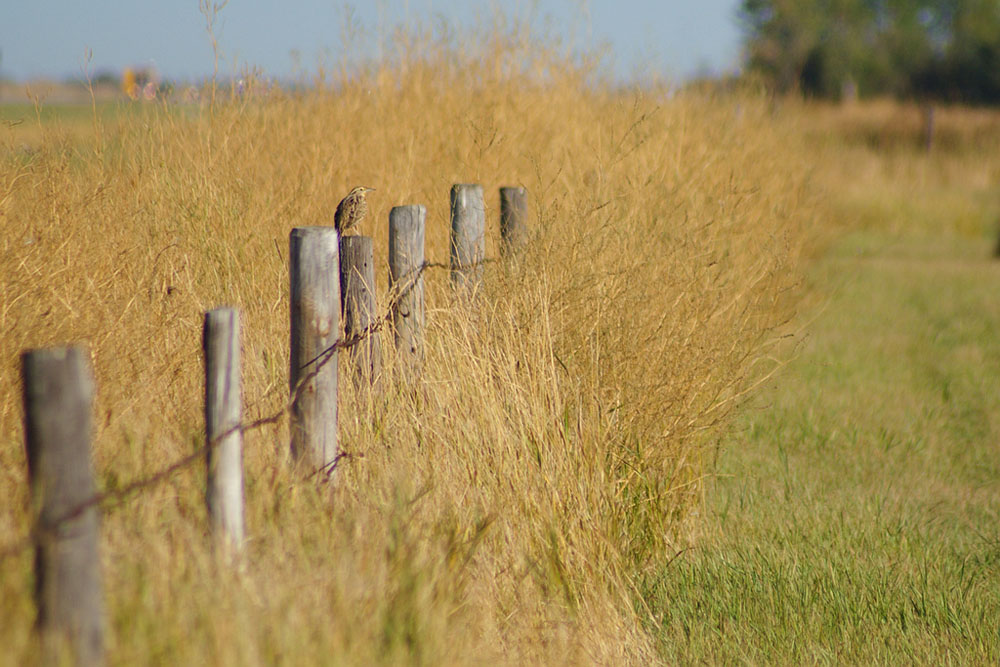
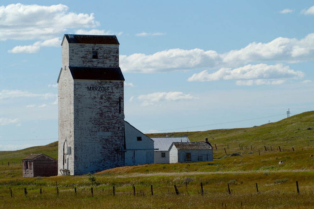
Temperate Grasslands: Agriculture & Development
Surpassing coral reefs, tropical rainforests, and old growth forests for endangered status is the temperate grasslands, which have been declared by the International Union for the Conservation of Nature as the least protected and most endangered type of ecosystem in the world. Canada’s prairie grasslands are some of the most vulnerable, with more than 70 per cent of its native grassland having been converted to crops and other development. These delicate ecosystems support more than 60 species at risk, and have a long history of cattle grazing. Once plowed, their deep, ancient root networks— essential for carbon sequestration, and therefore fighting global warming— are destroyed, and the land is rapidly colonized by European grasses. Restoration projects, such as those by the Nature Conservancy of Canada, and sustainable grazing initiatives such as the Blackfoot Confederacy’s Iinnii Initiative to protect buffalo, are fighting to keep the grasslands alive. Without federal protections, however, the grasslands are vulnerable to market influences and will be tilled, planted, and built-up as our society demands.

BIO/ SARAH TASLIMI, OALA, CSLA, ISA, IS A LANDSCAPE ARCHITECT, ARBORIST, AVID GARDENER AND SEASONAL KNITTING ENTHUSIAST LIVING IN KITCHENER.