Walking in Brampton
Text by Kaari Kitawi
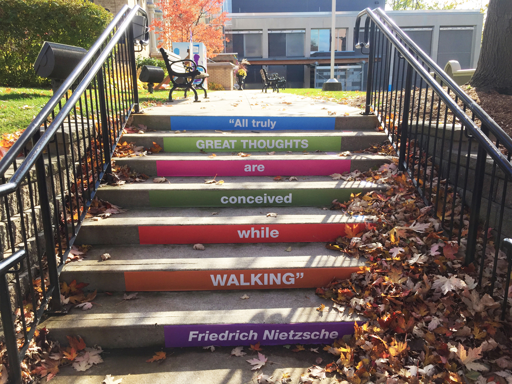
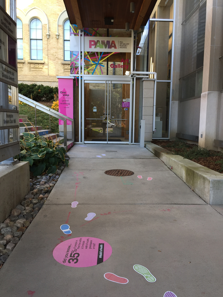
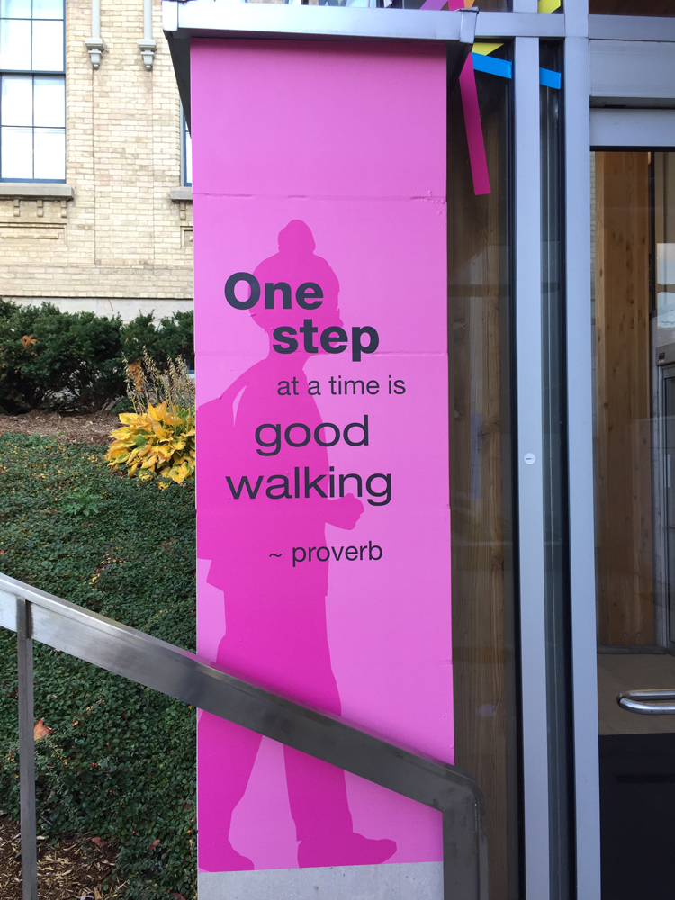
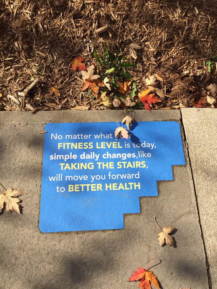
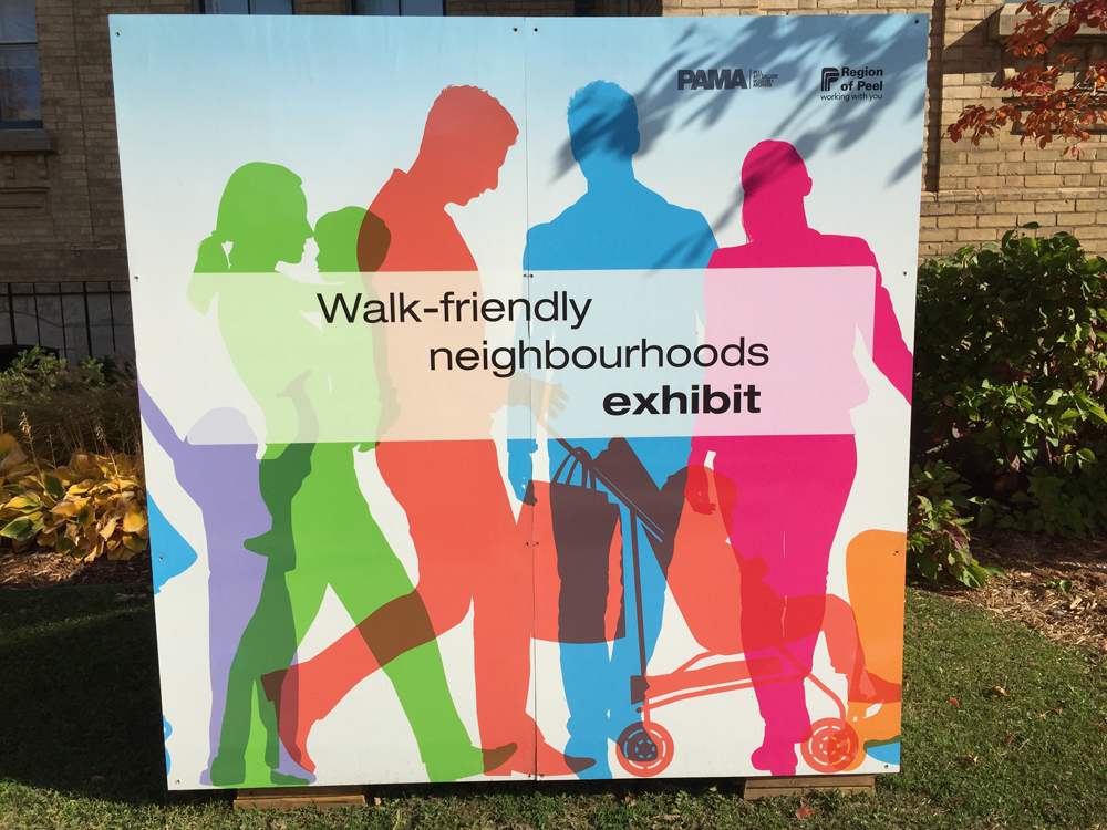
Early last fall, the Region of Peel had a Walk Friendly Neighbourhood Exhibition for six weeks, at the Peel Art Gallery, Museum and Archives (PAMA), in downtown Brampton. The free exhibition invited the residents to walk “while exploring the connection between community design and health.” The entire exhibition was outdoors, in the front yard-adjacent Main Street, and had coloured footsteps along the sidewalk that guided visitors through the exhibit, with various facts about walking, including health benefits, and the plans the Region was making to make neighbourhoods more walkable.
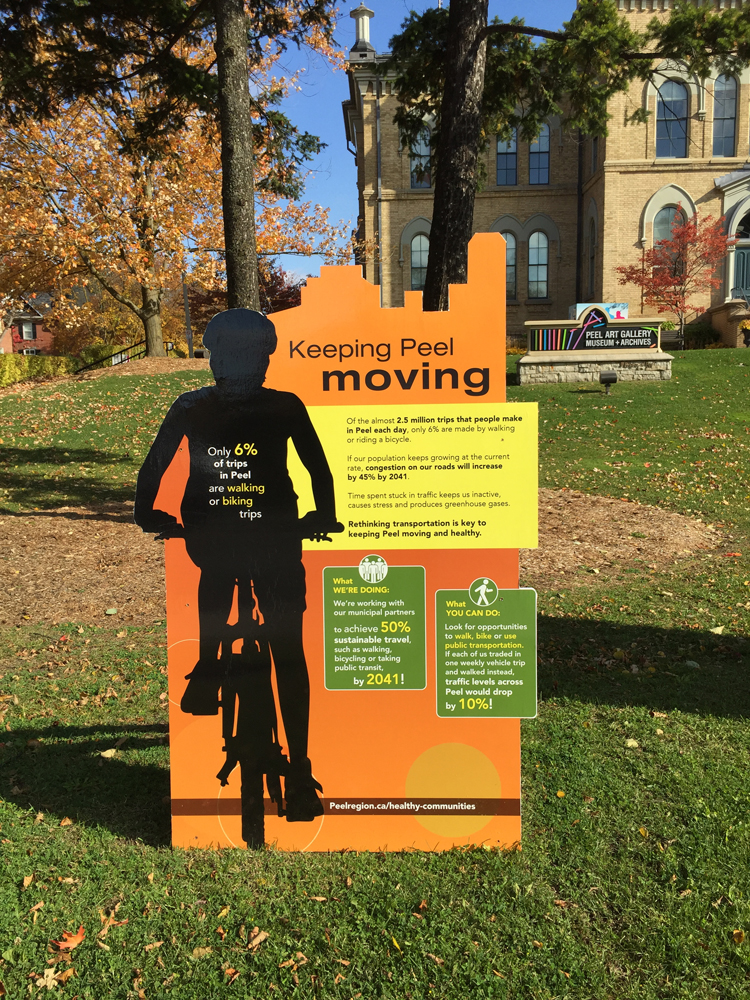
Recent studies on the health of Peel residents are alarming. The number of residents with a chronic disease such as diabetes is 40 per cent higher than the Ontario average. Car-centric neighbourhoods have been identified as encouraging sedentary lifestyles, with studies showing that out of the 2.5 million trips made a day in Peel, only six per cent are by walking or biking. The Region of Peel is encouraging residents to incorporate active lifestyle choices, and is even going further to reverse past poor development trends, to ensure new neighbourhoods are designed to encourage walking and biking. Dr. Jessica Hopkins, medical officer of health for the Region of Peel, rightfully points out that “community design can be re-imagined to better support physical activity by making it safe, easy and fun to walk, bicycle and play outside.”
Brampton is part of the Region of Peel, and is Ontario’s third largest city, with a population of 600,000 people. It’s currently growing at 2.5 times the national average. The city has a well-connected road network, with three major east-west regional roads running through it: Steeles Avenue, Queen Street (Highway 7), and Bovaird Drive, as well as numerous north-south regional and local roads. It has a robust transit system that is linked, citywide and regionally, by buses and trains. However, Brampton’s planning policies of segregated land uses has fostered a car-centric suburb, contributing to a sedentary lifestyle.
Interestingly, despite these land use policies, Brampton has an extensive pedestrian network consisting of sidewalks, multi-use trails, and recreational trails, that weaves through the city, connecting natural features, parks, schools, transit, recreation centres, neighbourhoods, and commercial centres. So why are many residents choosing to drive and not walk? Jeff Speck, in his book Walkable City, asserts that for a city to be walkable, the walk must be simultaneously useful, safe, comfortable, and interesting. The scenic recreation trails in Brampton are well-used, it is the sidewalks along major and minor arterial roads that are not used as much as they should. The pedestrian environment along the major arterial roads is harsh, the roads are eight lanes wide, with concrete medians, and tall street lights, and the edges have struggling street trees.
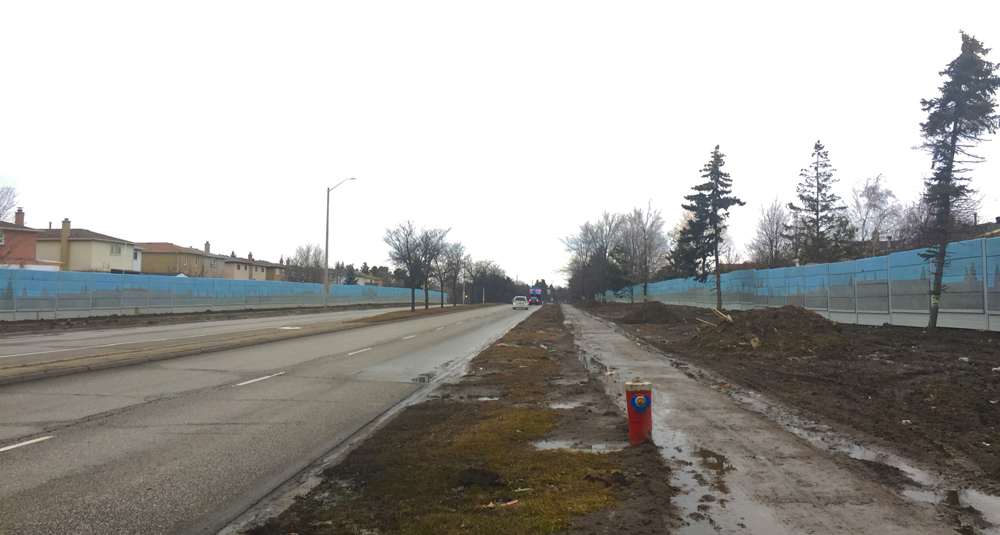
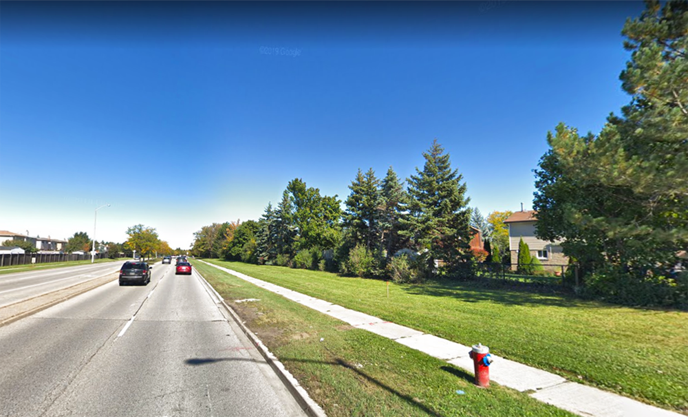
Allan B. Jacobs, in his seminal book Great Streets says “good streets… make a journey comfortable, safe, pleasing and even enlightening in terms of the experience they offer of the city.” One of few major roads in the city that exemplifies some of these characters is Williams Parkway, particularly between McLaughlin and Airport Road. It is a four-lane road, approximately 15 kilometres long, with intermittent landscaped medians, that runs east to west of Brampton. The landform adjacent to the parkway varies from undulating to fairly flat, while the edges alternate from mature trees, dense shrubbery, low transparent chainlink fences, no fences, and opaque wood fences. Directly abutting the parkway are eight schools, 10 parks, and several natural heritage features, including an ecological park and Etobicoke Creek, and numerous houses. Williams Parkway’s dynamic character serves as a type of “wayfinding,” providing natural landmarks to residents as they move through it.
Unfortunately, the character of Williams Parkway changed drastically over the last year, when the City began installation of a noise attenuation fence between McLaughlin Road and North Park. The fence was part of the City’s Transportation Master Plan to widen Williams Parkway to six lanes. The estimated budget for the fence was $10.8 million. The construction began in November 2018, and was scheduled to be completed by October 2019. The construction works obliterated the unique street character of Williams Parkway, as numerous mature trees, large shrubs, and private fences were erased and replaced with an unsightly, monotonous, blue and grey concrete noise attenuation fence. The transparent privacy fences, which provided “eyes on the street” and a sense of place, are no more. The new, monolithic fence provides no visual cues on location, is disorienting, and an eyesore.
It was only after numerous complaints from the residents that council passed a motion on October 23, 2019 to stop construction works, saying the works contradicted Brampton’s Vision 2040 and the Active Transportation Master Plan. Regrettably, the decision came too late, as the damage had been done, and the street character had been completely altered.
There is some hope on the horizon as the City is undergoing a major paradigm shift, and is tapping into the best urban planners and thinkers in the North America to help transform Brampton into an “urban suburb.” In 2017, the City commissioned Larry Beasley, the internationally renowned urban planner and former chief planner for Vancouver, and the urban design firm CIVITAS Studio, to develop Brampton Vision 2040 to guide the city’s growth for the next two decades. Brampton Vision 2040 was endorsed by council in May 2018, and in April 2019 the City hired a new urban design manager, Yvonne Yeung, OALA, to spearhead the transformation. Yvonne has marshalled a team of talented staff and engaged Ken Greenberg, renowned urban designer and the former director of architecture and urban design for the City of Toronto, as the urban design strategic advisor to advance Brampton Vision 2040.
As part of the Active Mobility Charter, Brampton Vision 2040 promises to revamp most streets to be complete streets, increase street trees and integrate “other landscape interventions, ecological feature and local touches.” This is guaranteed to transform Brampton streets to be safe, sustainable, comfortable, and walkable. No doubt, there may be some missteps as the City’s departments synchronize their vision and working relationship. However, it is the hope of residents that the City will take bold steps to reverse any “damage” caused by previous practices and poor internal coordination, as it endeavours to be more walkable.
BIO/ Kaari Kitawi, OALA, has a background in landscape architecture and is an urban designer for the City of Toronto, and a Brampton resident.