Embrace the Water
The surface hydrology of southern Ontario has drastically been altered by human activity over the past 200 years. The region falls within the St. Lawrence Lowland, a physiographic classification used to describe the depression created by glaciation and characterized by the Great Lakes and the St. Lawrence River as they flow imperceptibly into the Atlantic Ocean. And yet, in a landscape shaped by water and ice, establishing a meaningful connection to water in the collective psyche of present-day inhabitants is a tenuous affair when only traces remain of the myriad streams and ponds that once covered this part of the province.
A former industrial port, Copenhagen has in recent decades transformed itself into a healthy and climate-resilient city. The blue infrastructure projects that permeate the Danish capital across scales and typologies demonstrate how equitable access to water can be woven into urban fabric aesthetically, sustainably, and playfully.
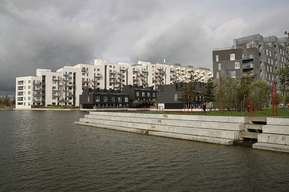
From homes, to streets, to public institutions, water pervades all aspects of Copenhagen life. The city’s newer residential waterfront neighbourhoods, situated on former port, industrial or waste lands, are created from an updated vernacular harbour architecture where berths are reconfigured as suntanning and fishing terraces, and where footbridges span canals that manage surface run-off and delineate mid-rise apartment building extents. Water is part of domestic life, and an enduring connection with it is maintained, whether visually from within buildings, or literally from platforms and docks that form public open spaces.
City streets are being reconfigured in multi-functional ways for stormwater management and climate mitigation. In 2011 and 2014, Copenhagen suffered major storm events that caused significant flood damage to private and municipal infrastructure. As part of its climate adaptation strategy, the city chose “blue” solutions rather than expand its storm sewer system. A network of 300 projects comprising roads that have been reprofiled to convey stormwater superficially, roads that detain water, and public open spaces that act as larger detention areas is planned to spread over the city. Two recently completed projects have redesigned a collector road and a local street to function as detention roads during extreme rain events and as urban park spaces when dry.
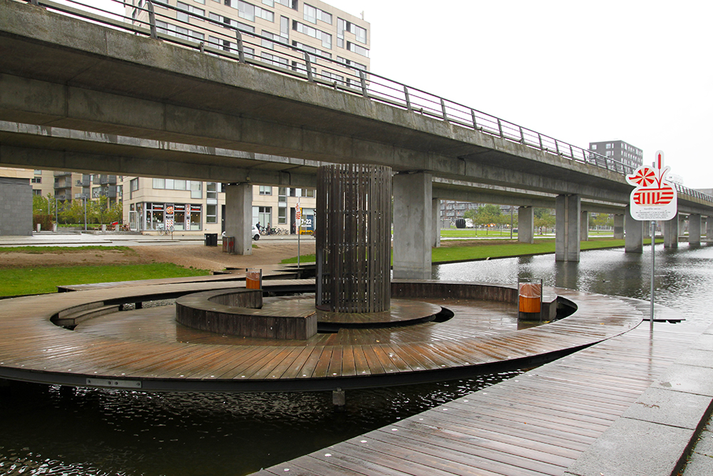
Even elevated transit corridors harness the infrastructural, ecological, aesthetic, and recreational aspects of water. The Ørestad canals that run beneath the M1 metro line handle stormwater from adjacent streets; the canals are connected to a large wetland that absorbs run-off before excess is discharged into the harbour, and though they are a more structured extension of the wetland, the canals are host to fish and waterfowl. The canals allow for kayaking and boating in summer and for ice skating in winter. Three platforms at the water’s edge provide seating, windbreaks, and staging areas, all within reach of apartments and a school.
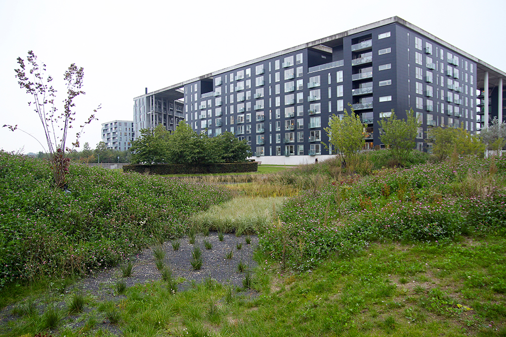
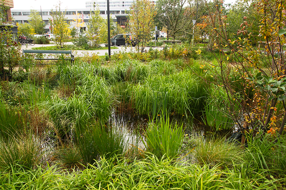
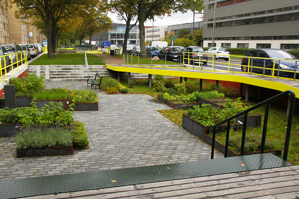
Located at the edge of the city core, university campuses synthesize the typologies of park, garden, and urban wild. Benefitting from a relatively greater amount of open space, the campus landscapes serve students as well as inhabitants of adjacent residential neighbourhoods. Secondary circulation networks are softer and more permeable than main, accessible routes, and informal planting palettes use hardy species indicative of local ecologies. Most striking is the celebration of the movement of water through canals, rills, and mirror pools. Stormwater management ponds are not isolated or fenced off—they are integral to the landscape.
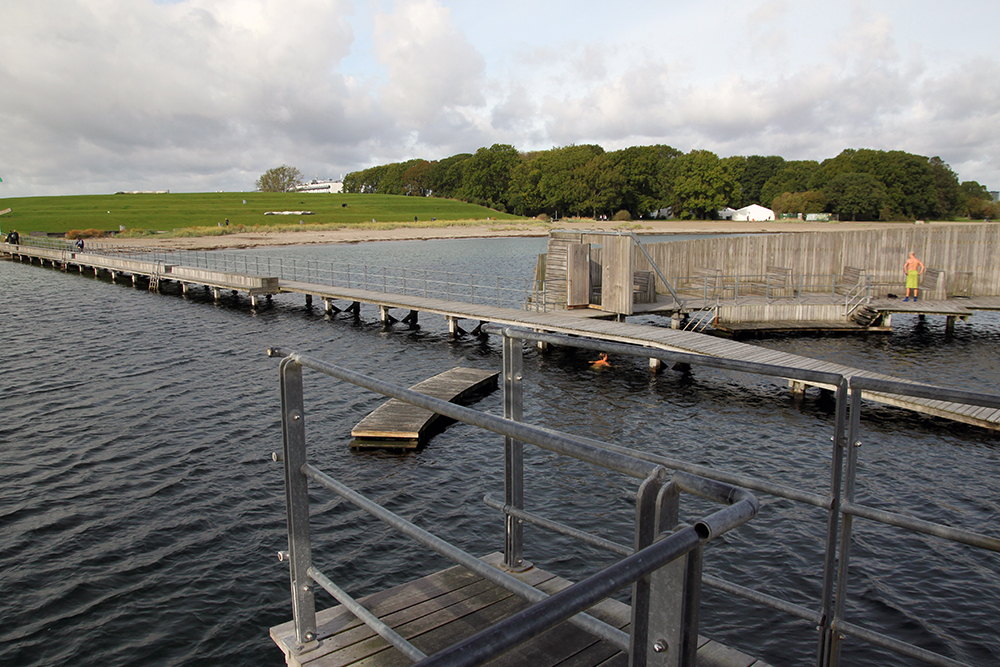
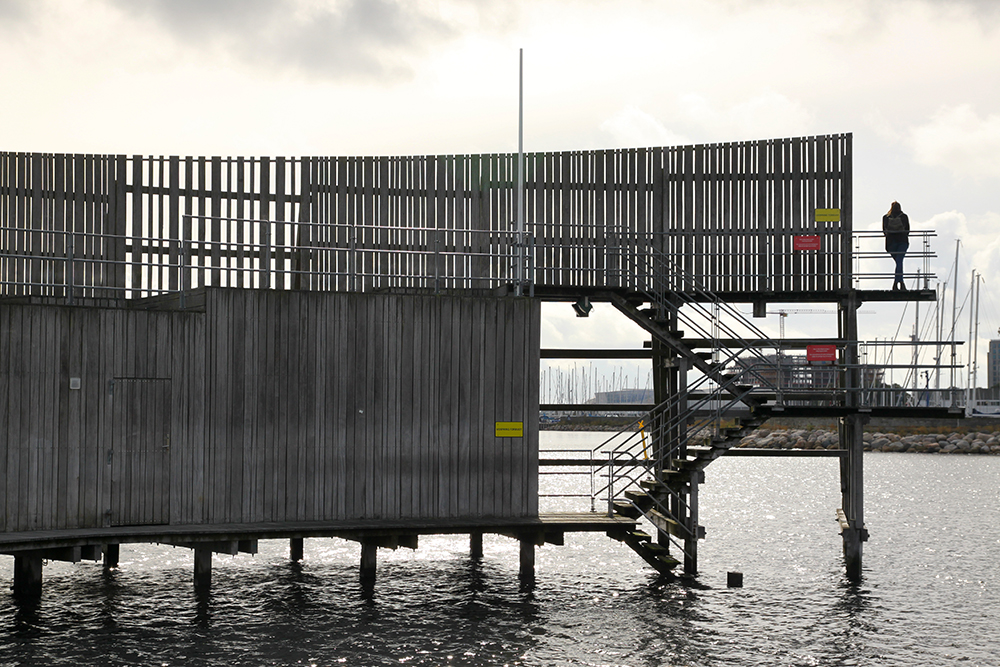
At once exalted and egalitarian, bathing stations offer everyone a visceral experience of Copenhagen’s larger bodies of water. Basic stations have enclosed swimming areas, springboards, and ladders, while the more elaborate ones include change rooms, washrooms, play equipment, docks, and platforms of varying heights. Ramps make the stations accessible, and lighting facilitates safe night-time enjoyment. Crowded and joyfully animated in summer, the stations provide shelter for solitary meditation or storm watching in winter.
These precedents can be adapted to southern Ontario’s increasingly densifying waterfront municipalities as a means of developing a progressive urban relationship with water. A new surface hydrology can replace the existing, dysfunctional drainage system with one equal to the task of climate adaptation, all the while fostering an equitable, meaningful connection to an essential resource. It is possible to build cities that embrace the water.
Here’s an animated visualization that depicts how these precedents could be deployed in the City of Toronto.
Text by Kamila Grigo, a landscape architect passionate about building resilient cities and vibrant communities through the design of public urban spaces. She has a background in visual culture and history and previously worked in the higher education industry. Her academic interests include visual representation, experiential aesthetics, and the intersection of cultural and ecological productivities. Kamila has served as guest critic and lecturer across the greater Toronto area, and her work has appeared in several landscape architecture publications.