Pattern as a Verb
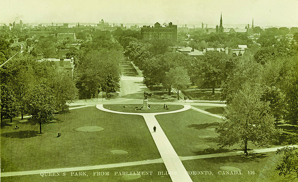
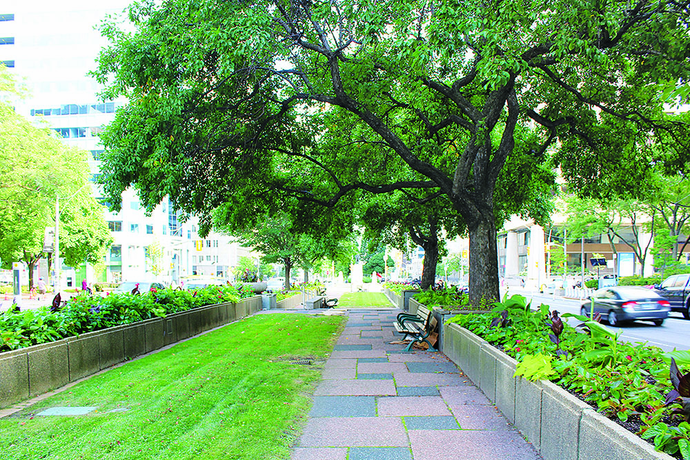
University Avenue is one of Toronto’s most prominent patterns. Since its inception, University has continuously changed to reflect the dominant ideologies of the times. Named College Ave. in 1829, University was a gated toll featuring a centre lane for carriages and lined on both sides with a sidewalk and double rows of chestnut trees designed by landscape gardener André Parmentier.
With its promenades and extended view, this allée originated from the French formal garden. The trimmed rows of chestnut trees, straight sidewalks and road, and orderly grass were all patterns expressing symmetry and order that suggested power and control over nature. The introduction of this colonial landscape was an important message for prospective settlers in the early 1800s. The Crown had recently purchased an astonishing 250,830 acres of land for 10 shillings in the 1805 Toronto Purchase Treaty with the Mississaugas. Successful settlement on this land, as David Wood describes in Perspectives on Landscape and Settlement on Nineteenth Century Ontario, would require the clearing of trees for an agricultural lifestyle.
As a white settler, I often reflect on how landscape architects across North America design on stolen land. Despite many Indigenous nations successfully occupying these lands for thousands of years, colonization has, and continues to introduce foreign patterns like the French allée into the physical landscape.
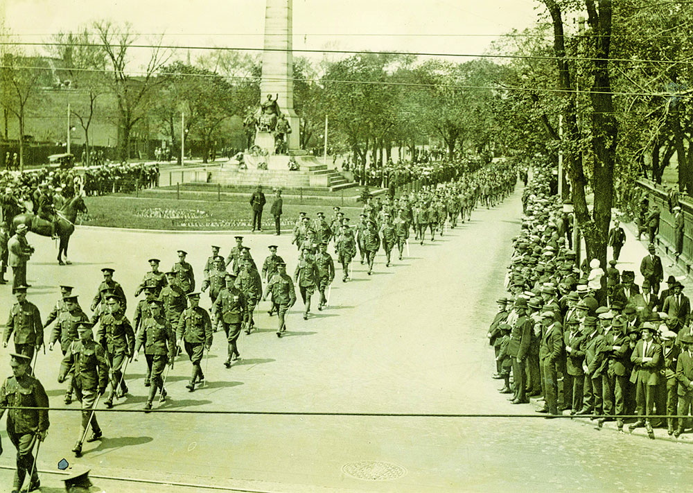
Monuments such as Canada’s participation in the Boer War, which saw colonial forces fighting over control of South Africa, reveal the importance University played in controlling the colonial narrative. This control extended even further into the public realm. Infrastructures, like the gated toll established in 1829, depict the growing significance of the public realm as a place for social regulation in the Victorian era. As Joanna Brück describes in Landscapes of Desire, public spaces in Victorian Ireland were similarly places where dominant social ideologies were constructed and perpetuated. The infrastructures within these public landscapes, from drinking fountains to benches, created regulated spaces where people were evaluated based on their behaviours.
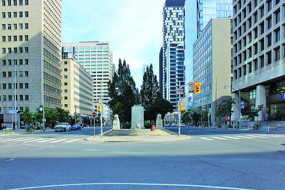
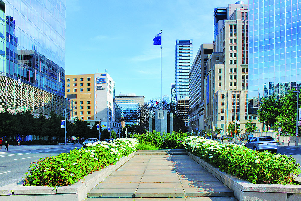
University evidently remains a place of power and control, physically and socially. It continues to be viewed as a representation of Toronto’s, and even Canada’s, historical and present-day dominant ideologies. Now considered a boulevard, it is a major transit corridor with six car lanes above ground and the Yonge-University subway line below ground. In the middle runs a linear park designed by Dunington-Grubb & Stensson in 1964 that, while underused today, was a spectacle at the time. It is a place where monuments have risen, parades have marched, and protests have thrived. In an international context, University Avenue presents Toronto as a place of economic vitality and world-renowned hospital care and scientific research.
In the context of the COVID-19 pandemic, the patterns of colonization across Toronto’s streets have become ever more apparent. COVID-19 is undoubtedly highlighting the general lack of space and infrastructure along the streets of Toronto. It is also highlighting the disparity between these streets, where advocacy and financial support are given to prioritized physical and social infrastructures in prioritized spaces, including University Ave.
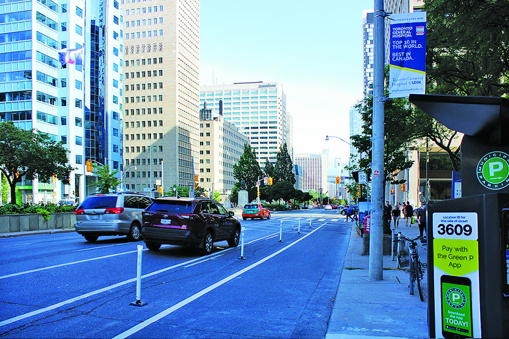
In June, protected bike lanes were installed along University Avenue and Queen’s Park Crescent in Toronto, from Bloor Street to Adelaide Street. Using the existing street, white plastic posts and road markings create a safe way for University Ave. hospital workers to get to their destinations and maintain physical distancing. The shift to create bike lanes and permanently take space away from cars is an ideological one reflecting decades-long advocacy combined with the urgent need for health professionals to safely commute to hospitals along University during the pandemic.
Although bike lane infrastructure is not exceptional, the time and advocacy required to implement it is. The presence or absence of infrastructures, from adequate sidewalk space, bike lanes, benches, street trees, and so on, is a matter of public inequity. In times of COVID, this inequity is putting the health and safety of the public at risk.
Conversations around the lack of cycling and pedestrian infrastructure elsewhere in Toronto’s public realm have spiked since the onset of COVID-19 as commuters started to avoid public transit. Narrow sidewalks have made the two-metre social distancing requirement impossible, even along large, popular streets like Yonge. A video from the Toronto Public Space Committee revealed how one person wearing a “social distance machine”—a two-metre wide circle of plastic tubing—struggles to move through the sidewalks of Toronto while maintaining the appropriate distance from other people and obstacles, often being forced to step out into the road and risk their safety. Although City projects like CaféTO and CurbTO are expanding outdoor restaurants, business storefronts, and pedestrian clearways, these changes are temporary. These projects are also inherently flawed, requiring businesses and organizations to first apply for expansions, thus limiting where sidewalk expansion can occur. This has created inconsistent spacing along sidewalks, and often results in bottlenecks.
While improvements to the public realm along popular streets like University are welcomed and important, the majority Toronto’s streets are far from on their way to creating equitable public spaces during this COVID-19 pandemic. Prioritizing cars over pedestrians and cyclists, small and uneven sidewalks that make life difficult for people who use mobility devices, and benches discouraging a good rest are all examples of infrastructure that perpetuates power imbalances in the public realm, and where car ownership dictates whether or not you have adequate space to move through the city.
Amidst a global pandemic and the Black Lives Matter Movement, a radical change in our priorities seems vital and imminent. The historical white and male-dominated design profession has created and perpetrated a pattern of inequity. With unprecedented spending now earmarked for economic recovery in Toronto, how will landscape architects respond to the inequalities that exist within the public realm? As designers, we must first look backwards and inwards to acknowledge the legacies of power and control embedded in designed landscapes and the ideologies we hold dear. Only this way can we find new patterns to move forward with.
BIO/Alexandra Ntoukas is a 2020 MLA graduate from the Daniels Faculty of Architecture, Landscape, and Design at the University of Toronto, where she also received an Honours B.Sc. with double-majors in Ecology & Evolutionary Biology and Psychology. Her 2020 thesis work focused on the exhibition of forest cycles through the lens of invasive species, largely stemming from her role as “In-Museum Scientist” in Mark Dion’s The Life of a Dead Tree exhibit at the Museum of Contemporary Art in Toronto, 2019. She has previously worked for the Irvine Design Group at BrightView Landscape Development Inc., where she worked on comprehensive design-build-maintenance projects along the Golden Coast. She is also a Ground editorial board member.